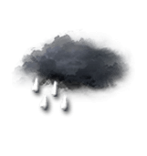
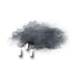
Amount of precipitationAmount of precipitation(mm)
Type of precipitationType of precipitation
Risks:
Precipitation riskPrecipitation risk(%)
Storm risk.(%)
Brightness:
Humidity(%)
Visibility(km)
UV
Temperature
Air tempAir temp
Perceived temp
Air temp
Perceived temp
Zero degree isotherm(m)
Rain / snow limitRain / snow limit(m)
Wind
Average windsAverage winds
Gusts
10m above ground level:
Direction
Speed
Gusts
Health
Pressure
(hPa)
(hPa)
Pressure(hPa)
Pollen (grains/m3) :
Pollen (Birch)
Pollen (Olive tree)
Pollen (Grasses)
Pollen (Ragweed)
Air quality index:
Pollution (ATMO)
Pollution (AQI)
Pollution (CAQI)
9
6
3
0
20
15
10
5
0
70
60
50
40
30
30
20
10
0
50
40
30
20
10
15
10
5
0
30
20
10
0
1030
1020
1010
1000
Thu 29
19h
20h
21h
22h
23h
00h
01h
02h
03h
04h
05h
06h
07h
08h
09h
10h
11h
12h
13h
14h
15h
16h
17h
18h
Run : 28/10 18ZMesh : 19kmUpdated, 34min agoUpdate in 5h
Thu 29
19h
20h
21h
22h
23h
00h
01h
02h
03h
04h
05h
06h
07h
08h
09h
10h
11h
12h
13h
14h
15h
16h
17h
18h
100
100
100
95
95
50
40
30
25
20
15
15
30
25
25
35
40
35
25
20
20
20
15
25
2.1
1.6
0.8
0
0
0
0
0
0
0
0
0
0
0
0
0
0
0
0
0
0
0
0
0
-
-
-
-
-
-
-
-
-
-
-
-
-
-
-
-
-
-
-
-
90
90
70
40
0
0
0
0
0
0
0
0
0
0
0
0
0
0
0
0
0
0
0
0
0
0
0
0
0
0
0
0
0
0
0
0
0
0
0
0
0
0
0
0
0
0
0
0
93
95
94
93
92
91
89
91
91
90
90
89
90
88
84
78
71
65
59
55
53
53
57
65
5
4
5
2
5
5
10
3
3
3
3
4
3
5
10
>20
>20
>20
>20
>20
>20
>20
>20
>20
0
0
0
0
0
0
0
0
0
0
0
0
0
0
0
1
2
2
3
2
1
1
0
0
1560
1559
1558
1457
1356
1254
1151
1049
947
846
744
643
542
541
642
744
846
947
1049
1050
1151
1151
1049
846
1253
1253
1153
1253
1050
948
846
745
643
541
540
439
338
337
338
542
745
949
1151
1152
1152
1151
948
643
3250
3200
3200
3150
3050
2900
2850
2850
2750
2750
2750
2700
2700
2600
2500
2450
2450
2450
2400
2400
2450
2500
2500
2450
2900
2900
2900
2850
2750
2600
2550
2550
2450
2450
2450
2400
2400
2300
2200
2150
2150
2150
2100
2100
2150
2200
2200
2150
220°SWSW
245°SWWSW
265°WW
275°WW
280°WW
285°WWNW
290°WWNW
285°WWNW
280°WW
285°WWNW
285°WWNW
285°WWNW
285°WWNW
285°WWNW
285°WWNW
295°NWWNW
295°NWWNW
300°NWWNW
295°NWWNW
295°NWWNW
295°NWWNW
295°NWWNW
295°NWWNW
295°NWWNW
1018511
917511
917511
61137
81549
81549
916410
61237
61237
61237
61137
61137
61237
61237
81449
917511
1018511
1018511
1018511
1018511
917511
916410
81449
51036
24441227
22401125
1834921
1528817
19361022
21391124
21391124
1731919
1528817
1528817
1527817
1426716
1527817
1629818
1732920
19361022
19361022
19361022
19361022
19351022
1833921
1732920
1528817
1223614
1010
1011
1011
1012
1013
1014
1015
1016
1017
1017
1018
1019
1019
1020
1021
1022
1022
1022
1022
1022
1022
1022
1022
1023
Data available from March 1 to July 31
Data available from January 1 to June 30]></target>
</trans-unit>
<trans-unit id="vymQBbs" resname="pollen_grass.unavailable">
<source>pollen_grass.unavailable</source>
<target><![CDATA[Data available from March 1 to August 31