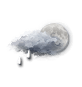
Weather mountain resort Bad Hofgastein

Bad Hofgastein AUTLon : 13°6’,2334 E Lat : 47°10’,2498 N Alt : 856m
Tue
30
-
- -
Wed
31
-
- -
Thu
01
-
- -
Fri
02
-
- -
Sat
03
-
- -
Sun
04
-
- -
Mon
05
-
- -
Tue
06
-
- -
Wed
07
-
- -
Thu
08
-
- -
Fri
09
-
- -
Sat
10
-
- -
Sun
11
-
- -
Mon
12
-
- -
Tue
13
-
- -
Tuesday 30 december Tuesday 30 dec
Reliability 85%

BULLETIN

(* established in local time)

Morning

Top 2650m
-14 °
Ressentie -16 °
due to the wind
310° NW NW 9 nd 16 km/h 4 m/s 10 mph
Gusts at 23 nd 43 km/h 12 m/s 27 mph
Very cloudy sky with short sunny periods.
No precipitation.
Fresh snow : < 1 cm
1024 hPa Visibility 10 km
Bottom 840m
-5 °
Ressentie -7 °
330° NW NNW 7 nd 13 km/h 4 m/s 8 mph
Gusts at 21 nd 39 km/h 11 m/s 24 mph
Very cloudy sky with short sunny periods.
No precipitation.
Fresh snow : < 1 cm
1023 hPa Visibility >20 km
Map settings
Models

Afternoon

Top 2650m
-13 °
Ressentie -15 °
due to the wind
325° NW NW 9 nd 17 km/h 5 m/s 11 mph
Gusts at 25 nd 47 km/h 13 m/s 29 mph
Very cloudy to overcast sky.
Risk of a few snowflakes.
Fresh snow : < 1 cm
1025 hPa Visibility >20 km
Bottom 840m
-3 °
Ressentie -5 °
335° NW NNW 8 nd 15 km/h 4 m/s 9 mph
Gusts at 24 nd 44 km/h 12 m/s 27 mph
Very cloudy sky with short sunny periods.
Risk of snow showers.
Fresh snow : < 1 cm
1024 hPa Visibility >20 km
Map settings
Models

Evening

Top 2650m
-16 °
Ressentie -19 °
due to the wind
320° NW NW 10 nd 18 km/h 5 m/s 11 mph
Gusts at 25 nd 47 km/h 13 m/s 29 mph
Very cloudy to overcast sky.
Risk of a few snowflakes.
Fresh snow : < 1 cm
1027 hPa Visibility >20 km
Bottom 840m
-7 °
Ressentie -9 °
due to the wind
325° NW NNW 7 nd 13 km/h 4 m/s 8 mph
Gusts at 22 nd 40 km/h 11 m/s 25 mph
Very cloudy to overcast sky.
Risk of a few snowflakes.
Fresh snow : < 1 cm
1026 hPa Visibility >20 km
Map settings
Models

Night

Top 2650m
-17 °
Ressentie -20 °
due to the wind
320° NW NW 9 nd 17 km/h 5 m/s 11 mph
Gusts at 25 nd 46 km/h 13 m/s 29 mph
Very cloudy sky with short clear periods.
Warning: conditions favourable to black ice.
Fresh snow : < 1 cm
1027 hPa Visibility 10 km
Bottom 840m
-9 °
Ressentie -10 °
330° NW NNW 7 nd 13 km/h 4 m/s 8 mph
Gusts at 21 nd 39 km/h 11 m/s 24 mph
Very cloudy sky with short clear periods.
Warning: conditions favourable to black ice.
Fresh snow : < 1 cm
1027 hPa Visibility >20 km
Map settings
Models
These forecasts are for subscribers only
For detailed 15-day forecasts
Subscribe!
Forecasts established in local time
Last updated 2h ago | Next update in 1h
Caption

Station information Bad Hofgastein

With skiinfo.fr
Updated on Monday 29 December 2026
Station open

Open from 12/12/25 to 12/04/26

Snow information

Top : 55 cm
Bottom : 20 cm
Latest snowfall : 3 cm le 5/12/25
Avalanche risk : NC

Skiing information

Open slopes : 15 / 27
0 /
7 / 11
7 / 13
1 / 3
Open ski lifts : 14 / 18
Nordic skiing : NC
Ski-in, ski-out : Not reported.

Expert opinion

Today in Bad Hofgastein, it will be cold and the atmosphere will become unstable.
Very cloudy skies with short clear spells. No precipitation in the morning, risk of snow showers in the afternoon. Light winds.

We are 85% sure of the situation, because there is a strong probability of snowfall.

Temperatures will vary between -5 and -3°C, it will be very cold in the morning.

Tonight, very cloudy.
Warning: icy conditions likely. Light winds.

Tue
30
-
- -
Wed
31
-
- -
Thu
01
-
- -
Fri
02
-
- -
Sat
03
-
- -
Sun
04
-
- -
Mon
05
-
- -
Tue
06
-
- -
Wed
07
-
- -
Thu
08
-
- -
Fri
09
-
- -
Sat
10
-
- -
Sun
11
-
- -
Mon
12
-
- -
Tue
13
-
- -
English