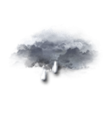
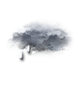
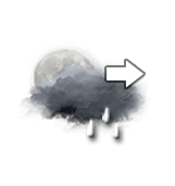
Weather mountain resort Tignes

Tignes FRALon : 6°54 E Lat : 45°28’,0002 N Alt : 2100m
Mon
30
-
- -
Tue
31
-
- -
Wed
01
-
- -
Thu
02
-
- -
Fri
03
-
- -
Sat
04
-
- -
Sun
05
-
- -
Mon
06
-
- -
Tue
07
-
- -
Wed
08
-
- -
Thu
09
-
- -
Fri
10
-
- -
Sat
11
-
- -
Sun
12
-
- -
Mon
13
-
- -
Monday 30 march Monday 30 mar
Reliability 70%

BULLETIN

(* established in local time)

Night

Top 3450m
-12 °
Ressentie -13 °
250° W WSW 7 nd 13 km/h 4 m/s 8 mph
Gusts at 16 nd 30 km/h 8 m/s 19 mph
Veiled cloud turning overcast as cloud thickens.
No precipitation.
Fresh snow : < 1 cm
1028 hPa Visibility >20 km
Bottom 1550m
-6 °
Ressentie -7 °
235° SW SW 5 nd 9 km/h 3 m/s 6 mph
Gusts at 12 nd 22 km/h 6 m/s 14 mph
CLEAR SKY clouding over gradually.
No precipitation.
Fresh snow : < 1 cm
1028 hPa Visibility >20 km
Map settings
Models

Morning

Top 3450m
-13 °
Ressentie -15 °
255° W WSW 8 nd 15 km/h 4 m/s 9 mph
Gusts at 28 nd 51 km/h 14 m/s 32 mph
Very cloudy to overcast sky.
Risk of a few snowflakes.
Fresh snow : < 1 cm
1027 hPa Visibility 15 km
Bottom 1550m
-7 °
Ressentie -9 °
260° W W 6 nd 11 km/h 3 m/s 7 mph
Gusts at 24 nd 45 km/h 13 m/s 28 mph
Very cloudy sky with short sunny periods.
Risk of a few snowflakes.
Fresh snow : < 1 cm
1027 hPa Visibility 15 km
Map settings
Models

Afternoon

Top 3450m
-9 °
Ressentie -9 °
275° W W 12 nd 22 km/h 6 m/s 14 mph
Gusts at 36 nd 66 km/h 18 m/s 41 mph
Very cloudy to overcast sky.
Snow showers starting to fall at the end of the afternoon.
Fresh snow : < 1 cm
1025 hPa Visibility >20 km
Bottom 1550m
-2 °
Ressentie -1 °
290° W WNW 10 nd 18 km/h 5 m/s 11 mph
Gusts at 33 nd 62 km/h 17 m/s 39 mph
Very cloudy to overcast sky.
Snow showers clearing later.
Fresh snow : < 1 cm
1025 hPa Visibility >20 km
Map settings
Models

Evening

Top 3450m
-10 °
Ressentie -14 °
due to the wind
290° W WNW 13 nd 24 km/h 7 m/s 15 mph
Gusts at 36 nd 67 km/h 19 m/s 42 mph
Very cloudy to overcast sky.
Light snow showers.
Fresh snow : 5 cm
1022 hPa Visibility >20 km
Bottom 1550m
-4 °
Ressentie -8 °
due to the wind
295° NW WNW 11 nd 20 km/h 6 m/s 12 mph
Gusts at 33 nd 61 km/h 17 m/s 38 mph
Very cloudy to overcast sky.
Light snow showers.
Fresh snow : 3 cm
1022 hPa Visibility >20 km
Map settings
Models

Night

Top 3450m
-12 °
Ressentie -16 °
due to the wind
290° W WNW 13 nd 25 km/h 7 m/s 16 mph
Gusts at 36 nd 66 km/h 18 m/s 41 mph
Very cloudy to overcast sky.
Snow showers clearing later.
Fresh snow : < 1 cm
1024 hPa Visibility >20 km
Bottom 1550m
-6 °
Ressentie -9 °
due to the wind
290° W WNW 10 nd 18 km/h 5 m/s 11 mph
Gusts at 31 nd 58 km/h 16 m/s 36 mph
Very cloudy to overcast sky.
Snow showers clearing later.
Fresh snow : < 1 cm
1023 hPa Visibility >20 km
Map settings
Models
These forecasts are for subscribers only
For detailed 15-day forecasts
Subscribe!
Forecasts established in local time
Last updated 1h ago | Next update in 2h
Caption

Station information Tignes

With skiinfo.fr
Updated on 29/03/2026
Station open

Open from 22/11/25 to 3/05/26

Snow information

Top : 170 cm
Bottom : 136 cm
Latest snowfall : 5 cm le 29/03/26
Avalanche risk : 2 / 5 Reduced risk

Skiing information

Open slopes : 80 / 83
9 / 9
35 / 35
19 / 19
17 / 20
Open ski lifts : 42 / 43
Nordic skiing : 5 km / 8 km
Ski-in, ski-out : Total

Tignes - THE STATION

Tignes - La station Située à plus de 2000 mètres d'altitude, Tignes est l'une des plus grandes stations de ski françaises, reliée à Val d'Isère, pour former le domaine skiable Tignes - Val d'Isère de 300 km de pistes. La station allie modernité et festivités, avec une montée en gamme récente. La station se compose de quatre sites distincts : Val Claret, en haut de la vallée, mêle architecture moderne et chalets, avec l’inauguration en décembre 2022 d'un Club Med. Tignes le Lac, au cœur de la station, offre une variété architecturale, des bâtiments des années 60 aux hôtels et chalets plus récents. Tignes 1800, en bas près du barrage, est la plus récente avec de gros chalets et une église, offrant une vue agréable, mais moins d'animation. Les Brévières, sous le barrage à 1550 mètres d'altitude, est un village authentique relié aux pistes, bien que plus petit et moins animé.

Expert opinion

Today in Tignes, rain and snow will affect the region in the second half of the day.
Very cloudy skies to overcast. Risk of a few flurries in the morning, snowfalls late in the day. Light winds.

We are 70% sure of the situation, because in this type of situation, it is difficult to define precisely when the precipitation will begin.

Temperatures will vary between -9 and -3°C, it will be very cold in the morning and 5°C below normal.

Tonight, very cloudy skies to overcast.
Snowfalls. Moderate winds.

Mon
30
-
- -
Tue
31
-
- -
Wed
01
-
- -
Thu
02
-
- -
Fri
03
-
- -
Sat
04
-
- -
Sun
05
-
- -
Mon
06
-
- -
Tue
07
-
- -
Wed
08
-
- -
Thu
09
-
- -
Fri
10
-
- -
Sat
11
-
- -
Sun
12
-
- -
Mon
13
-
- -
English