Weather mountain resort Le Mourtis

Boutx FRALon : 0°46’,0002 W Lat : 42°55’,0002 N Alt : 1350m
Thu
14
-
- -
Fri
15
-
- -
Sat
16
-
- -
Sun
17
-
- -
Mon
18
-
- -
Tue
19
-
- -
Wed
20
-
- -
Thu
21
-
- -
Fri
22
-
- -
Sat
23
-
- -
Sun
24
-
- -
Mon
25
-
- -
Tue
26
-
- -
Wed
27
-
- -
Thu
28
-
- -

BULLETIN

Reliability 80%
Thursday 14 may Thursday 14 may

Night

Top 1860m
0 °
Ressentie 0 °
275° W W 3 nd 5 km/h 1 m/s 3 mph
Gusts at 13 nd 25 km/h 7 m/s 16 mph
Overcast sky becoming unsettled.
Risk of a few drops of rain.
Fresh snow : < 1 cm
1017 hPa Visibility 4 km
Bottom 1350m
3 °
Ressentie 2 °
255° W WSW 3 nd 6 km/h 2 m/s 4 mph
Gusts at 14 nd 26 km/h 7 m/s 16 mph
Overcast sky becoming unsettled.
Light rain clearing gradually.
Fresh snow : < 1 cm
1017 hPa Visibility 5 km

Morning

Top 1860m
0 °
Ressentie -1 °
275° W W 6 nd 12 km/h 3 m/s 7 mph
Gusts at 20 nd 37 km/h 10 m/s 23 mph
Very cloudy to overcast sky.
Snow showers starting to fall at the end of the morning.
Fresh snow : < 1 cm
1012 hPa Visibility 10 km
Bottom 1350m
2 °
Ressentie 1 °
245° SW WSW 5 nd 10 km/h 3 m/s 6 mph
Gusts at 18 nd 34 km/h 9 m/s 21 mph
Very cloudy to overcast sky.
Drizzle starting to fall at the end of the morning.
Fresh snow : < 1 cm
1012 hPa Visibility 10 km

Afternoon

Top 1860m
4 °
Ressentie 6 °
due to the sun
290° W WNW 9 nd 17 km/h 5 m/s 11 mph
Gusts at 28 nd 52 km/h 14 m/s 32 mph
Very cloudy to overcast sky.
Snow showers clearing later.
Fresh snow : < 1 cm
1009 hPa Visibility 5 km
Bottom 1350m
7 °
Ressentie 9 °
due to the sun
285° W WNW 9 nd 16 km/h 4 m/s 10 mph
Gusts at 28 nd 51 km/h 14 m/s 32 mph
Very cloudy to overcast sky.
Gradually fading light showers.
Fresh snow : < 1 cm
1009 hPa Visibility 5 km

Evening

Top 1860m
1 °
Ressentie -1 °
295° NW WNW 8 nd 15 km/h 4 m/s 9 mph
Gusts at 26 nd 48 km/h 13 m/s 30 mph
Very cloudy sky turning overcast.
Snow showers starting to fall at the end of the evening.
Fresh snow : < 1 cm
1008 hPa Visibility 5 km
Bottom 1350m
3 °
Ressentie 2 °
280° W WNW 8 nd 14 km/h 4 m/s 9 mph
Gusts at 25 nd 47 km/h 13 m/s 29 mph
Very cloudy sky turning overcast.
Drizzle starting to fall at the end of the evening.
Fresh snow : < 1 cm
1008 hPa Visibility 5 km

Night

Top 1860m
0 °
Ressentie -1 °
275° W W 3 nd 5 km/h 1 m/s 3 mph
Gusts at 13 nd 24 km/h 7 m/s 15 mph
Overcast and misty. Limited visibility.
Light snow showers.
Fresh snow : 2 cm
1005 hPa Visibility 2 km
Bottom 1350m
3 °
Ressentie 2 °
250° W WSW 3 nd 5 km/h 1 m/s 3 mph
Gusts at 12 nd 23 km/h 6 m/s 14 mph
Overcast and misty. Limited visibility.
Persistent drizzle.
Fresh snow : < 1 cm
1005 hPa Visibility 1 km
These forecasts are for subscribers only
For detailed 15-day forecasts
Subscribe!
Forecasts established in local time
Caption   Glossary

Station information Le Mourtis

With skiinfo.fr
Updated on 13/05/2026
Station closed (end of season)

Open from 19/12/26 to 21/03/27

Snow information

Top : 220 cm
Bottom : 150 cm
Latest snowfall : 10 cm le 20/02/26
Avalanche risk : 2 / 5 Reduced risk

Skiing information

Open slopes : 0 / 12
0 / 4
0 / 3
0 / 3
0 / 2
Open ski lifts : 0 / 10
Nordic skiing : NC
Ski-in, ski-out : Not reported.

Expert opinion

Today in Le Mourtis, warning: strong gusts in the afternoon.
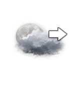
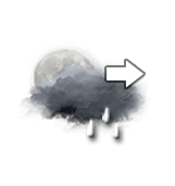
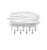
Very cloudy skies to overcast. Drizzle beginning to fall in late morning, light showers dying away progressively in the afternoon.

We are 80% sure of the situation, because it is possible that the change in the rain system may not be as clear as forecast.

Temperatures will vary between 2 and 7°C, it will be cold in the morning and 6°C below normal.

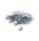
Tonight, overcast skies with wet-weather low cloud.
Drizzle. Light winds.

Thu
14
-
- -
Fri
15
-
- -
Sat
16
-
- -
Sun
17
-
- -
Mon
18
-
- -
Tue
19
-
- -
Wed
20
-
- -
Thu
21
-
- -
Fri
22
-
- -
Sat
23
-
- -
Sun
24
-
- -
Mon
25
-
- -
Tue
26
-
- -
Wed
27
-
- -
Thu
28
-
- -
English